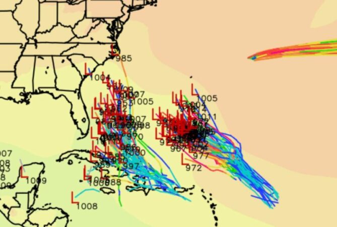
Tropical Storm Humberto has formed in the central Atlantic Ocean and is rapidly intensifying as forecasters track multiple weather systems threatening various regions across the Atlantic basin. The storm, which became the eighth named storm of the 2025 Atlantic hurricane season on September 24, is expected to strengthen into a Category 3 or 4 hurricane over the weekend while remaining safely offshore from the United States mainland.
Current Status and Immediate Forecast
Humberto’s Position as of September 26, 2025:
Location: Approximately 748 kilometres (465 miles) east-northeast of the northern Leeward Islands
Maximum sustained winds: 65 mph (104 km/h) – approaching hurricane strength
Movement: Northwest at 6 mph – unusually slow forward motion
Pressure: Steadily decreasing, indicating continued strengthening
Hurricane Formation Imminent
The National Hurricane Centre expects Humberto to achieve hurricane status by Friday afternoon, September 27, 2025, with continued intensification through the weekend. Meteorologists predict the storm could reach major hurricane status (Category 3-4) by Sunday or Monday as it encounters exceptionally favourable atmospheric conditions.
Projected Path and Bermuda Threat
Anticipated Track:
Weekend: Northwest movement through central Atlantic
Early next week: Northward turn between Bermuda and the U.S. East Coast
Tuesday-Wednesday: Potential close approach to Bermuda as a major hurricane
Bermuda Advisory: Residents of Bermuda should monitor Humberto’s progress closely, as the storm may pass just west of the island chain early next week, potentially bringing dangerous winds, coastal flooding, and destructive waves. The proximity and intensity of Humberto’s approach will determine the severity of impacts on the British territory.
Developing Caribbean Threat: Future “Imelda”
Invest 94L Evolution
While Humberto poses minimal direct threat to the United States, meteorologists are increasingly concerned about Invest 94L, a tropical disturbance currently affecting the northern Caribbean. This system is already producing heavy rainfall and gusty winds across Puerto Rico, the Dominican Republic, Haiti, and the Virgin Islands.
Development Timeline:
Thursday-Friday: Continued organisation as the system moves through the Caribbean
Saturday-Sunday: Expected formation into Tropical Storm Imelda near the Bahamas
Monday-Tuesday: Potential impact on Southeastern United States
U.S. East Coast Implications
Southeast Regional Threat Assessment
The developing system poses a significant threat to the Carolinas, Georgia, and potentially Virginia early next week. Jonathan Blaes, meteorologist at the National Weather Service Raleigh office, stated: “It is quite likely that some portion of this developing system, which would become Imelda, will either get very close to the Carolina coast or go across the coast”.
Potential Impact Timeline:
Friday-Saturday: System strengthens near the Bahamas
Sunday: Possible hurricane-strength approach toward the Southeast coast
Monday-Tuesday: Landfall or close approach to the Carolinas most probable
Complex Atmospheric Interactions
The Fujiwhara Effect Possibility
Meteorologists are monitoring a rare atmospheric phenomenon called the Fujiwhara Effect, where two tropical systems can orbit around each other when they come within approximately 900 miles. This interaction between Humberto and the developing Imelda could dramatically alter both storms’ paths and intensities.
Interaction Scenarios:
Humberto dominates: Pulls weaker Imelda harmlessly out to sea
Independent development: Both storms maintain separate paths
Orbital interaction: Systems rotate around common center, creating unpredictable outcomes
Forecast Complications
The potential interaction adds significant uncertainty to predictions. Alex DaSilva, AccuWeather Lead Hurricane Expert, noted: “This setup is rare and highly complex. The last time something similar occurred near the U.S. was in 2016, when Hurricanes Matthew and Nicole were about 800 miles apart”.
Hurricane Gabrielle’s European Trajectory
Azores Under Hurricane Warning
Simultaneously, Hurricane Gabrielle continues its eastward march toward Europe, with hurricane warnings in effect for Portugal’s Azores Islands. The Category 3 hurricane is expected to bring dangerous conditions Thursday night and Friday, including:
Damaging winds up to 85 mph
Coastal flooding and destructive waves
Up to 5 inches of rainfall across central and western Azores
Continued impact on Bermuda and U.S. East Coast beaches through dangerous surf
Preparedness and Safety Concerns
Regional Preparedness Advisories
For Bermuda:
Monitor Humberto’s intensity and track closely
Prepare for potential Category 3-4 hurricane conditions early next week
Secure property and review emergency plans
For U.S. Southeast Coast:
North Carolina residents are particularly urged to monitor the developing situation
Hurricane Helene’s anniversary serves as a reminder of potential mountain flooding risks
Flash flood preparations recommended for inland areas
Beach and Marine Safety:
Life-threatening rip currents expected along the entire U.S. East Coast
Dangerous surf conditions from both Humberto and Gabrielle
Small craft advisories likely through next week
Seasonal Context and Climate Patterns
2025 Atlantic Hurricane Season Activity
The formation of Humberto breaks what had been an unusually quiet period in tropical development. Bryan Norcross, Fox Weather hurricane specialist, explained: “It’s very unusual to have no systems develop between late August and mid-September”. The recent activity represents a significant shift in seasonal patterns, with multiple systems now active simultaneously.
Critical Development Factors:
Exceptionally warm sea surface temperatures supporting rapid intensification
Reduced wind shear allowing organized development
Favorable atmospheric patterns across the Atlantic basin
Extended Forecast and Uncertainties
Modeling Challenges
Forecasters acknowledge significant uncertainty in current predictions due to the complex interactions between multiple systems. Roger Martin, National Weather Service meteorologist in New Bern, North Carolina, emphasised: “Given chaotic steering, a run today can appear significantly different from a run of the same model on a different day”.
Key Forecast Variables:
Jet stream positioning over the eastern United States
Timing of Imelda’s development and strengthening rate
Humberto’s size and proximity affect the interaction potential
Upper-level atmospheric patterns influencing storm steering
Looking Ahead: Weekend and Early Week
Critical Development Period
The next 72 hours will prove crucial for determining impacts across multiple regions. Six hurricane hunter flights are scheduled for September 25-26 to provide critical reconnaissance data for both systems. This information will help refine forecasts and provide more precise impact predictions.
Residents throughout the Bahamas, the U.S. East Coast from Florida to North Carolina, and Bermuda should remain vigilant and prepared for rapidly changing conditions as these tropical systems continue to evolve in the coming days.
The simultaneous activity of multiple significant tropical systems underscores the unpredictable and potentially dangerous nature of the late-season Atlantic hurricane period, requiring continued monitoring and preparedness across the affected regions.