Bihar continues to experience an active monsoon phase with thunderstorms, lightning, and rainfall predicted across several regions. The India Meteorological Department (IMD) has issued a yellow alert for districts in eastern and north-central Bihar, forecasting thundercloud activity, lightning strikes, and wind speeds ranging between 30 to 40 kilometers per hour.
Rainfall is expected to be more intense in north Bihar compared to the southern parts of the state. Districts including Araria, Kishanganj, and Supaul have been specifically warned about the possibility of heavy rainfall at isolated locations.
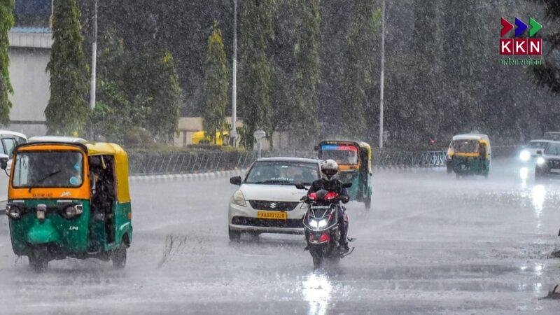
Light to Moderate Rainfall Reported in Most Districts
According to official data from the Meteorological Centre in Patna, several parts of Bihar witnessed light to moderate rainfall on Saturday. Thunderstorm activity was recorded in many locations. Madhubani experienced wind gusts reaching up to 52 kilometers per hour.
This ongoing monsoon pattern has affected both temperature and humidity levels across the state. The presence of rain clouds and intermittent showers led to a drop in maximum temperatures, while the minimum temperatures rose slightly due to the moisture-laden air.
The highest recorded temperature in the state was 36 degrees Celsius in Valmikinagar and Dehri, while the lowest temperature of 24.1 degrees Celsius was recorded at Agwanpur in Saharsa.
Rainfall in North Bihar Surpasses the South
The IMD’s regional center in Patna noted a more active monsoon system in North Bihar, with frequent rain showers and thunderstorm activity continuing across multiple districts. The rainfall disparity between the northern and southern zones has widened over the last few days, with the north receiving more precipitation and experiencing stronger weather patterns.
Meteorologists attribute this variation to the current low-pressure system developing in the northern Bay of Bengal, which is influencing the weather conditions over the eastern Gangetic plains, including Bihar.
Impact of Low-Pressure System from Bay of Bengal
The low-pressure area, which has formed over the northern Bay of Bengal, is expected to move west-northwestward over the next two days. It will likely influence weather conditions in Gangetic West Bengal, northern Odisha, Jharkhand, and adjoining northern Chhattisgarh.
This system is projected to bring scattered rainfall with occasional thunderstorms to several parts of Bihar. The IMD has highlighted the potential for localised heavy rainfall due to this movement.
IMD’s Forecast for the Next 24 Hours
In its latest advisory, the Meteorological Centre, Patna, stated that many parts of Bihar, including Patna, are expected to witness cloudy skies, intermittent showers, and gusty winds in the next 24 hours.
There is a warning in place for five districts, namely Rohtas, Bhabhua, Aurangabad, Buxar, and Kaimur, where isolated locations may receive heavy rainfall. These regions are at higher risk of waterlogging, reduced visibility, and temporary disruption of local transportation services.
Regional Highlights and Rainfall Analysis
The rain distribution across Bihar has been uneven. While southern districts such as Gaya, Jehanabad, and Nalanda have received moderate showers, northern and northeastern districts like Purnia, Araria, and Supaul have seen more intense rainfall events.
Meteorologists have stated that these variations are typical of monsoon dynamics, especially when systems develop over the Bay of Bengal. The trajectory and intensity of such weather systems largely determine the rainfall patterns across Bihar.
Storm Systems Strengthen Rain Activity in North Bihar
North Bihar remains under significant weather influence due to the interaction between monsoon currents and local pressure systems. These interactions often cause intense rain events, especially during the late evening and early morning hours.
Experts have observed that thundercloud formation, known as cumulonimbus development, is higher in these regions. This results in frequent lightning, accompanied by short bursts of heavy rain and strong wind gusts.
Residents are advised to remain alert, especially during periods of high lightning activity. Farmers, in particular, should take precautions to avoid open fields during thunderstorms, as Bihar continues to witness fatal lightning incidents during the monsoon season every year.
Yellow Alert: What It Means for the Public
The Yellow Alert issued by the IMD signifies a moderate risk of adverse weather conditions. While not considered extremely dangerous, it is a signal for preparedness. Citizens are advised to monitor local weather updates, avoid unnecessary travel during storms, and secure loose items outdoors.
Authorities in the affected districts have been informed about the alert and are expected to take precautionary measures, including drainage readiness, disaster response coordination, and public information dissemination through local radio, social media, and mobile alerts.
Monsoon Outlook for the Coming Days
According to meteorologists, Bihar will remain under the influence of active monsoon systems for at least the next five to six days. Scattered rainfall, occasional thunderstorms, and localized heavy downpours will continue to affect both rural and urban areas.
In urban centres like Patna, Muzaffarpur, and Bhagalpur, the rain may cause minor waterlogging, especially in low-lying neighbourhoods. Meanwhile, in agricultural zones, the rainfall will likely benefit standing paddy crops, although excess rain could lead to soil saturation and crop stress if drainage is inadequate.
Historical Weather Trends in Bihar
Bihar typically receives a majority of its annual rainfall during the monsoon months from June to September. The average rainfall ranges from 1000 to 1200 mm annually, with significant variation depending on regional geography and evolving weather systems.
Historically, July and August have been the wettest months. However, in recent years, weather anomalies like delayed monsoons, prolonged dry spells, and sudden cloudbursts have disrupted farming schedules and urban infrastructure alike.
Climate Experts on Changing Patterns
Climate researchers have noted that Bihar is experiencing more frequent weather fluctuations, possibly linked to climate change. Sudden shifts in wind patterns, increasing lightning events, and intensifying rainfall systems are becoming common.
According to climatologists, the warming of the Bay of Bengal, combined with global temperature rise, may be contributing to the increased intensity of monsoon depressions and cyclonic circulation over eastern India.
These shifts necessitate better disaster preparedness, stronger urban drainage planning, and early warning systems that reach every household.
Advisory for Farmers and Local Residents
Farmers across Bihar are encouraged to stay in touch with Krishi Vigyan Kendras (Agricultural Science Centres) for crop-specific weather guidance. Given the expected rainfall, they should prioritize field drainage and avoid sowing new seeds until conditions stabilize.
Local residents, especially in rural areas, should avoid standing under trees during lightning, stay away from water bodies during storms, and keep mobile phones charged in case of power cuts.
Government Preparedness and Response
The Disaster Management Department of Bihar has instructed district administrations to remain on standby for potential flooding or waterlogging incidents. Rescue teams, flood response units, and medical services have been alerted in vulnerable districts.
Municipal bodies in cities like Patna and Gaya have been directed to clean stormwater drains, ensure garbage removal, and decongest clogged water pathways to prevent urban flooding.
With active weather systems developing over the Bay of Bengal and affecting the entire eastern region, Bihar is likely to experience continued rainfall activity in the coming days.
Residents are urged to follow local weather updates, comply with safety advisories, and remain indoors during severe thunderstorms. Farmers, travellers, and outdoor workers should take extra precautions during the peak rainfall hours.